Applications
Automated mobility is of key interest to a range of different mobility applications – several of which will be investigated in iLIDS4SAM. LiDAR is generally regarded a key enabling technology to implement the required safety functions for automated mobility. On the long run, LiDAR sensors are expected to replace radar as the No 1 automotive ADAS sensor technology.
Beyond the automotive application, the LiDAR system is of relevance for a range of further applications requiring optimized systems for object detection and classification based on a robust, accurate and affordable sensor and dedicated algorithms. These advantages will boost the development of safe and affordable autonomous vehicles and machines in many additional areas, including rail-bound traffic, industrial surveillance, anti-collision for helicopters and/or UAVs, Simultaneous Localization and Mapping (SLAM) of robots used for disaster analysis and recovery, surveying in mining or agricultural vehicles, and many other applications, where robustness and price are the most challenging factors.
Furthermore, for the highly relevant simulation and validation of driver assistance and autonomous systems in urban environments, new test and reference systems based on the high-resolution LiDAR sensor will be developed within iLIDS4SAM. Selected use cases, including road and rail as well as agricultural applications, will be implemented and tested to demonstrate the practical relevance and capability of the approach.
Applications
Specific test-scenarios will be defined within the progress of the project for three different fields of application, which would strongly benefit from the unique properties of the iLIDS4SAM sensor:
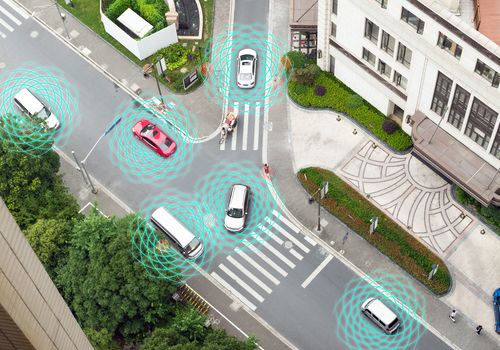
Autonomous driving in urban environment
The typical sensors used in automated driving systems are radar, LiDAR and cameras. Each of these types of sensors has their own strengths and weaknesses. For this reason, most work targeting higher SAE levels is using some combination of sensors.
It was recognized very early that LiDAR sensors play a crucial role in achieving higher levels of automated driving. Current sensors often are expensive and too bulky to be integrated into the chassis. Recent market studies confirm the need for more advanced and integrable LiDAR sensors with a forecasted target price range of 200 – 350 US$ per sensor. The iLIDS4SAM project will fulfill this simultaneously technology- and market-driven need for innovation in this seminal growth field with the development of novel and innovative MEMS-based LiDAR sensors.
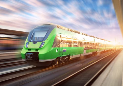
Railroad safety
Up to date autonomous rail systems have been realized only in closed track systems mainly for metro systems (e.g. DLR in London or Nürnberg U2) or airport systems. These closed tracks have neither railway crossings nor other conflicting traffic. The two core problems in autonomous rail traffic are (i) surveillance of the clearing and (ii) surveillance of railway crossings. Due to long breaking distances and the inability to leave the track, sensors observing the clearance must have significantly higher range and must be able to adapt to the track environment (tunnels, curves ….).
The use of wide-angle LiDAR systems would enable checking of light secured railroad crossings by monitoring whether approaching vehicles stop correctly. Solving these two major problems provides a substantial prerequisite for urban and suburban commuter rail traffic.
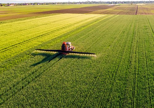
Agricultural applications
State of the art in automatization for agricultural applications is the use of GPS-guided systems. Tractors are led along tracks defined by GPS-points. For a small number of use-cases (i.e. guidance along of plant-rows) cameras are used as sensors. GPS-guided systems show a number of disadvantages concerning reliability, safety and costs (charge for GPS-signal, disturbances, reflexions, communication, no obstacle awareness). On the other hand, sensor-based systems are independent of external signals and can build up a precise (3D) image of the environment and deliver data which can be used for a number of additional features like obstacle detection and plant identification / analysis, rising safety and benefit for the user remarkably, also in addition to GPS. Unfortunately, these features are not available by now due to the high costs for the necessary sensors.
A precise, available, affordable and robust LiDAR will speed up development and reduce costs dramatically. This will be the first and vital step into the agricultural market, where the price is the limiting factor.